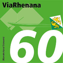
The route via the Untersee lake and Hochrhein river was for centuries Switzerland's most important waterway. Today, it follows the ViaRhenana from Kreuzlingen via Schaffhausen to Basel, through a varied landscape shaped by water.
This website uses cookies to improve your user experience. By continuing to use this website, you consent to the use of cookies.
Cookie settings
Technically necessary cookies
Technisch notwendige Cookies sind zur einwandfreien Funktion unserer Webseite erforderlich und können nicht deaktiviert werden.
Cookies for statistical purposes
Analytische Cookies ermöglichen es uns, Besuche und Verkehrsquellen zu zählen, damit wir die Leistung unserer Webseite messen und verbessern können. Sie unterstützen uns bei der Beantwortung der Fragen, welche Seiten am beliebtesten sind, welche am wenigsten genutzt werden und wie sich Besucher auf der Webseite bewegen. Alle von diesen Cookies erfassten Informationen werden aggregiert und sind deshalb anonym.
Cookies for marketing purposes
Marketing Cookies können von unseren Werbepartnern auf unserer Webseite gesetzt werden. Sie können von diesen Unternehmen verwendet werden, um ein Profil Ihrer Interessen zu erstellen und Ihnen relevante Werbung auf anderen Webseiten zu zeigen. Sie funktionieren durch eindeutige Identifikation Ihres Browsers und Ihres Geräts. Sie nehmen hiermit zur Kenntnis und willigen mit der Aktivierung dieser Cookies ein, dass die von solchen Cookies erhobenen Informationen an Anbieter ausserhalb der Schweiz und der EU gesendet werden, einschliesslich in Länder mit (aus der Sicht des schweizerischen Datenschutzgesetzes) nicht-angemessenem Datenschutz (z.B. Vereinigten Staaten, Singapur und Taiwan). Sie nehmen hiermit weiter zur Kenntnis, dass ins Ausland übermittelte Daten nicht mehr vom schweizerischen Recht geschützt sind und ausländische Gesetze sowie behördliche Anordnungen die Weitergabe dieser Daten an Behörden und andere Dritte verlangen können.